Whether you're a developer or you're just curious, you should check out the Special and Impaired Waters search tool at the MPCA construction stormwater Web site. You can zoom in to a particular area of interest--Roseville (take a look at the picture below) for instance--and see whether its lakes are listed by the MPCA as being polluted (i.e. impaired) for things like excess nutrients, chloride and/or mercury.
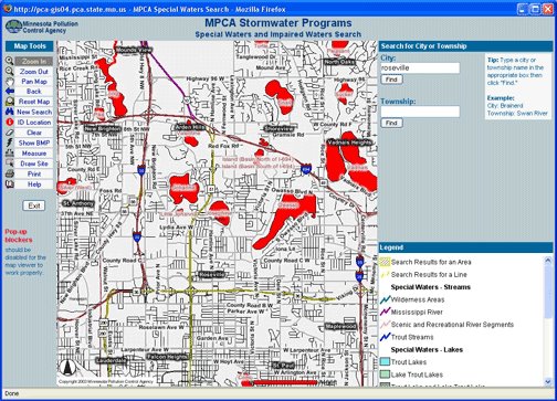 Anyone can see the quality of surface water in Minnesota lakes and rivers with the MPCA's GIS mapping tool. Here's a map of Roseville. © 2006 MPCA
With the tools on the left side of the page, you can ID locations, measure distances and more through the power of GIS mapping. This could come in handy for construction site operators who need to maintain specific distances from 'special waters' like wetlands.
1 comment:
Would be good to list specific impairments and to be able to delete/shrink big black township/city labels.
Post a Comment